Designing Solutions

How GIS Surveys Can Be Used to Assess Natural Disaster Risk

Introduction

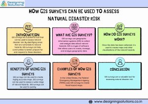
GIS surveys are a powerful tool that can be used to assess natural disaster risk. By identifying areas that are vulnerable to natural hazards, GIS surveys can help communities to better prepare for and respond to these disasters.
GIS Survey

What are GIS surveys?

GIS surveys use geographic information systems (GIS) to collect and analyze data about natural hazards. GIS is a type of software that allows users to create, manage, and analyze geographic data. GIS surveys can be used to collect data about a wide range of natural hazards, including floods, earthquakes, wildfires, and landslides.

How do GIS surveys work?

GIS surveys work by collecting data from a variety of sources, including:

  • Satellite imagery: Satellite imagery can be used to map the location and extent of natural hazards.
  • Aerial photography: Aerial photography can be used to provide high-resolution images of natural hazards.
  • Ground surveys: Ground surveys can be used to collect data about natural hazards that cannot be detected by satellite imagery or aerial photography.

Once the data has been collected, it is used to create maps and other visualizations of the natural hazards. These maps and visualizations can then be used to identify areas that are at risk and to develop mitigation and preparedness measures.

Benefits of using GIS surveys to assess natural disaster risk

There are a number of benefits to using GIS surveys to assess natural disaster risk, including:

  • Accuracy: GIS surveys can be used to create highly accurate maps and other visualizations of natural hazards. This information can then be used to make informed decisions about mitigation and preparedness measures.
  • Comprehensiveness: GIS surveys can be used to assess a wide range of natural hazards, including floods, earthquakes, wildfires, and landslides. This information can then be used to develop a comprehensive risk assessment plan.
  • Timeliness: GIS surveys can be used to quickly and efficiently collect and analyze data about natural hazards. This information can then be used to make timely decisions about mitigation and preparedness measures.

    Examples of how GIS surveys are being used to assess natural disaster risk

    Here are a few examples of how GIS surveys are being used to assess natural disaster risk around the world:

    These maps are used to identify areas that are at risk of flooding and to develop flood insurance programs

    In the United States, the Federal Emergency Management Agency (FEMA) uses GIS surveys to create flood hazard maps.

 In Japan, the government uses GIS surveys to create earthquake hazard maps

These maps are used to identify areas that are at risk of earthquakes and to develop earthquake-resistant building codes.

In Australia, the government uses GIS surveys to create wildfire risk maps

These maps are used to identify areas that are at risk of wildfires and to develop wildfire prevention and suppression plans.

How to use GIS surveys to assess natural disaster risk

If you are interested in using GIS surveys to assess natural disaster risk, there are a few things you need to do:

Identify the natural hazards that are relevant to your area 

This could include floods, earthquakes, wildfires, landslides, or other hazards.

Collect data about the natural hazards 

This data could include topographic data, geological data, vegetation data, and historical data.

Use GIS software to create maps and other visualizations of the natural hazards 

This information can then be used to identify areas that are at risk and to develop mitigation and preparedness measures.

If you do not have the expertise or resources to conduct a GIS survey yourself, you can hire a professional GIS consultant to help you.

Conclusion

GIS surveys are a valuable tool for assessing natural disaster risk. By using GIS surveys to identify areas that are vulnerable to natural hazards, communities can better prepare for and respond to these disasters.

How POI data collection is changing the way we live, work, and play

POI data collection is the process of gathering information about places of interest (POIs). POIs can be anything from restaurants and shops to museums and tourist attractions. POI data is collected from a variety of sources, including social media, GPS devices, and customer reviews.

POI data collection is having a major impact on the way we live, work, and play. Here are just a few examples:

  • Navigation: POI data makes it easier for us to navigate new places and find the things we need. For example, when we use a navigation app, POI data is used to show us the location of nearby restaurants, gas stations, and ATMs.

POI data is also being used to develop new navigation technologies, such as self-driving cars. Self-driving cars need to be able to identify and navigate around POIs in order to safely get from point A to point B.

  • Local search: POI data makes it easier for us to find local businesses and services. For example, when we search for “best restaurants near me” on Google, POI data is used to show us a list of restaurants in our area.

This is convenient for consumers, as it allows them to quickly and easily find the businesses and services they need. It is also beneficial for businesses, as it helps them to reach potential customers who are interested in their products or services.

  • Marketing: Businesses use POI data to target their marketing campaigns to potential customers. For example, a restaurant might use POI data to target people who live or work near their location.

POI data can also be used to create more personalized marketing campaigns. For example, a retailer might use POI data to send customers coupons for products that they are likely to be interested in, based on their past purchases.

  • Urban planning: City planners use POI data to make better decisions about how to develop and improve their cities. For example, POI data can be used to identify areas where there is a need for new businesses or services.

POI data can also be used to improve the design of cities. For example, city planners can use POI data to create pedestrian-friendly streets and to locate parks and public spaces in areas where they are most needed.

Other applications of POI data collection

POI data collection is also being used in a variety of other ways, including:

  • Public safety: POI data can be used to improve public safety by identifying areas where crime is more likely to occur. POI data can also be used to track the spread of diseases and to identify areas that are at risk for natural disasters.
  • Environmental protection: POI data can be used to protect the environment by identifying areas that are sensitive to pollution or development. POI data can also be used to track the movement of wildlife and to identify areas that need to be protected.
  • Social research: POI data can be used to conduct social research on a variety of topics, such as human mobility, consumer behavior, and social interaction. POI data can also be used to study the impact of public policies and social programs.

Conclusion

POI data collection is a powerful technology that is having a major impact on the way we live, work, and play. As POI data collection technology continues to develop, we can expect to see even more innovative and transformative applications for POI data in the future.

Steps to do Profile Mapping for OFC

Profile mapping for Occupational Families and Careers (OFC) is the process of identifying the skills and competencies required for different job roles within an organization. This information can then be used to develop training and development programs, create career pathways, and make better hiring decisions.


Step 1: Identify the job roles within your organization

The first step is to identify all of the job roles within your organization, both current and future. This includes all levels of positions, from entry-level to executive. You can use job descriptions, organizational charts, and other resources to identify all of the job roles.


Step 2: Define the skills and competencies required for each job role

Once you have identified all of the job roles, you need to define the skills and competencies required for each role. Consider both technical and soft skills. Technical skills are the specific skills required to perform the job, such as programming languages, software development tools, and data structures and algorithms. Soft skills are general skills that are important for success in any job, such as communication, teamwork, and problem-solving.

To define the skills and competencies required for each job role, you can review job descriptions, performance reviews, and employee surveys. You can also talk to managers and employees to get their input.


Step 3: Group the job roles into occupational families

Once you have defined the skills and competencies required for each job role, you need to group the job roles into occupational families. Occupational families are groups of job roles that require similar skills and competencies. For example, the IT Division occupational family might include job roles such as software engineer, web developer, and systems administrator.

Grouping job roles into occupational families will help you to identify common skills and competencies across different job roles. This information can then be used to develop training and development programs, create career pathways, and make better hiring decisions.


Step 4: Map the skills and competencies to each occupational family

Once you have grouped the job roles into occupational families, you need to map the skills and competencies to each occupational family. This will give you a clear picture of the skills and competencies required for each occupational family.

To map the skills and competencies to each occupational family, you can create a table or spreadsheet. List the occupational families in one column and the skills and competencies in the other columns. Then, indicate which skills and competencies are required for each occupational family.


Step 5: Use the profile mapping information to develop training and development programs, create career pathways, and make better hiring decisions

Once you have mapped the skills and competencies to each occupational family, you can use this information to develop training and development programs, create career pathways, and make better hiring decisions.


Training and development programs: The profile mapping information can be used to identify the skills and competencies that employees need to develop in order to advance their careers. Based on this information, you can develop training and development programs to help employees develop the skills and competencies they need to be successful in their current and future roles.


Career pathways: The profile mapping information can be used to create career pathways for employees. Career pathways are sequences of jobs that employees can move through as they develop their skills and competencies. By creating career pathways, you can help employees identify the skills and competencies they need to develop in order to advance their careers.


Hiring decisions: The profile mapping information can be used to make better hiring decisions. When you are hiring for a new role, you can compare the skills and competencies required for the role to the skills and competencies of the candidates you are interviewing. This will help you to identify the candidates who are most likely to be successful in the role.

Profile mapping for OFC is a valuable tool that can help you to develop your workforce and improve your organization’s performance. By following the steps above, you can create a profile mapping process that is tailored to your organization’s specific needs.

How Designing Solutions helps?

Designing Solutions is a leading provider of profile mapping services, with over 16 years of experience in the industry. We offer a wide range of profile mapping services for OFC.

We have a team of experienced and certified profile mapping professionals who can help you to develop and implement a profile mapping program that is tailored to your specific needs. We use a variety of tools and techniques to collect and analyze data, and we work with you to develop a profile mapping program that is both effective and efficient.

We understand that profile mapping can be a complex and time-consuming process, but we are here to help you every step of the way. We offer a variety of support services, including training, consultation, and ongoing support.

If you are interested in learning more about our profile mapping services for OFC, please contact us today. We would be happy to discuss your specific needs and develop a custom solution for your organization.